
Alarm over new West Coast hazard zones
24 Sep 2025
By Lois Williams, Local Democracy Reporter
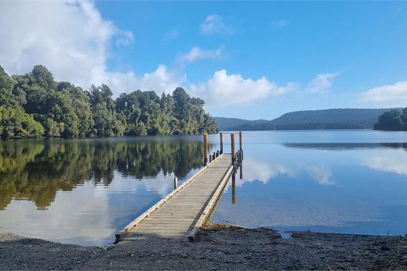
Council and iwi leaders agonising over the West Coast ‘One Plan’ have tackled what planners describe as its most complicated and emotive chapter -- the one on Natural Hazards.
The Tai o Poutini Plan (TTPP) committee is in the throes of a five-day meeting to decide whether to accept the recommendations of independent commissioners who heard public submissions on the massive document.
If adopted, the TTPP – which has been five years in the making and cost ratepayers nearly $8 million -- will set new planning rules for all three District Councils on the Coast: Westland, Grey and Buller.
The Hazards chapter of the TTPP, which maps areas prone to flooding, coastal storm surges, landslides, earthquakes and other risks, is also the one that’s stirred up the most feeling in the community, senior planner Lois Easton told the meeting on Monday.
“We had a lot of community members and landowners concerned about the impact of hazard identifications on their property values and their ability to insure,” she said.
But the main submitter urging councils to take a tougher approach to risk had been the Natural Hazards Commission (formerly EQC).
“They are in many ways the country’s largest insurer … but they don’t rely on what councils have done.”
Insurance companies were now doing their own assessments of natural hazards, Ms Easton said.
“So the arguments from submitters saying if you put a hazard overlay on our property it’s going to devalue it, actually the purpose is to stop people putting things in places where they won’t be able to get insurance.”
People should remember the plan rules applied only to new builds and additions in hazard areas, not to existing structures, she said.
“But it is a very emotional topic for people, because (their home) it’s their biggest investment.”
Public protest erupted in the midst of the plan process when the hazard maps changed after submissions closed, as new LiDAR survey data became available.
But the end result was worth it, in the view of committee chair Rex Williams.
“The original hazards work (for the TTPP) was done in the Covid era; it was hard to access consultants…and information. It’s fortuitous that the Hearings Panel has come along with a helicopter view of the whole thing and almost started again.”
The Panel has made some fundamental changes to the Hazard chapter.
Overlays (maps) showing ‘"flood susceptibility” have been removed where there is no scientific data to back them.
Those areas include Haast, Inangahua, Karamea, Ngakawau, Waimangaroa, Mokihinui, Nile River and surprisingly for some councillors: the Waiho (Waiau) and Tatare Rivers at Franz Josef.
“It undermines the credibility of the plan if we have big fat pen marks that aren’t well justified, and it’s unnecessarily punitive on landowners, Ms Easton said.
In the case of the Waiho (Waiau) River at Franz Josef, it was difficult to model the river because it changed so fast, but removing the overlay did not mean there was no hazard, she said.
The map shows a yellow ‘severe flood hazard’ area surrounding the town and the Tatare stream, which is being pushed back toward Franz Josef by the Waiho.
But a blue ‘flood susceptibility’ area including the township, has been removed by the Panel.
Westland mayor Helen Lash said the recommended change was bizarre.
“A lot of that land to the north is very high compared to the river but if (the Waiho) breaches on the northern side above the bridges, it’s going to come down through the town.”
Ms Easton said the map was based on known concerns.
“There was real concern we didn’t have robust hazard science … but I’m concerned that removing the (blue) overlay does create risk that development could be threatened."
However, Franz Josef was an area of multiple hazards, - including the Alpine Fault and it was probably hard to borrow money to build there, Ms Easton said.
Makaawhio leader Paul Madgwick said he could not understand why there was a severe hazard area around the Tatare stream.
“This is rising ground, the Tatare River is low and this (area) is the future site of Franz Josef township. Putting impediments in the way is not very helpful.”
(The Westland District Council hopes to move the town northwards over the next 15 years.)
Mrs Lash was alarmed that the Lake Tsunami Hazard overlay had also been removed from nearby Lake Mapourika.
“That’s actually very high risk ..when that earthquake comes there will be a significant tsunami in that lake which will go a long way up those shores."
Buffer zones restricting building along the Alpine fault have been replaced in the new hazard maps with two earthquake risk overlays-‘severe’ and ‘susceptible’, based on GNS data.
It was well-known that the Alpine Fault ran directly through the Franz Josef Police station - but the new overlays showed it also ran through the middle of the Taramakau stopbanks, further north, Cr Brett Cummings noted.
The meeting resumes – and ends - on Wednesday, when the TTPP committee must decide if it accepts the new Plan for the Coast.
LDR is local body journalism co-funded by RNZ and NZ On Air.

print this story

'Get on with it': Greens push for pre-election solar law
Thu 9 Jul 2026
By Shannon Morris-Williams | The Green Party is calling on Parliament to pass legislation enabling low-cost household solar finance before the election, arguing there is now cross-party support following Labour's SolarSaver announcement and National's earlier Home Energy Fund pledge.

Govt backs hydrogen with national industry summit
Thu 9 Jul 2026
By Oli Lewis | The Government is convening a major hydrogen conference to promote awareness and uptake of the alternative fuel.
Hurunui to notify climate solution plan change
Thu 9 Jul 2026
By David Hill, Local Democracy Reporter | A North Canterbury council is looking to progress "a uniquely Hurunui solution’’ to sea level rise.
Media round-up
Thu 9 Jul 2026
In our round-up of climate coverage in local media: The Government re-wrote fast-track law after mining companies pushed for change; costs from inland flooding are expected to rise by up to 53% by 2075; and is there such a thing as a sustainable tourist?

'Electric election': Labour promises $160m SolarSaver scheme funded by gas investment cuts
Wed 8 Jul 2026
By Oli Lewis | Labour is promising to reprioritise $160 million from the Gas Security Fund to pay for its new SolarSaver policy, designed to accelerate the roll-out of household solar.

Experts sound alarm over escalating climate impacts
Wed 8 Jul 2026
By Shannon Morris-Williams | Scientists are warning climate impacts are accelerating across our region after a World Meteorological Organization report found last year was the South-West Pacific's second-warmest on record, with impacts including rising seas, marine heatwaves and extreme weather.

Energy Minister completes overhaul of EECA board
Wed 8 Jul 2026
By Oli Lewis | The board of the Energy Efficiency & Conservation Authority (EECA) has been completely overhauled since the last election, with Energy Minister Simeon Brown responsible for all six appointments.

‘We sure as hell ain't sending billions offshore’: Luxon on Paris target
Wed 8 Jul 2026
By Liz Kivi | Prime Minister Christopher Luxon has again said he won’t “send billions offshore” to meet New Zealand’s international climate target.
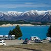
Pūkaki consent puts dry-year rules in spotlight
Wed 8 Jul 2026
Meridian Energy’s approval to draw Lake Pūkaki below its normal operating range has exposed a gap in New Zealand’s electricity security arrangements.

Seymour ‘imploring’ council to go easy on foresters is abuse of authority: EDS
Tue 7 Jul 2026
By Liz Kivi | The Environmental Defence Society says that Regulation Minister David Seymour’s attempt to influence Gisborne District Council to ‘go easy’ on forestry companies in enforcing environmental laws is a clear abuse of ministerial authority.