
Watch the carbon dioxide flow on Google Earth
27 Feb 2009
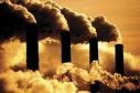
New interactive Google Earth maps, created by NASA, Purdue University and the Department of Energy, show the amount of carbon dioxide being dumped into the US atmosphere every hour.
The maps use existing data - everything from factory emissions report to census population figures - to estimate the CO2 output from the burning of 48 types of fossil fuels.
... login or subscribe for full story
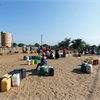
Africa facing up to $20 billion economic hit from 'super' El Niño, bank climate chief warns
Wed 29 Jul 2026
An impending "super" El Niño is likely to inflict a combined $10 billion to $20 billion hit on affected African countries and trigger mass migration from hard-hit areas, the African Development Bank's top climate expert told Reuters.

‘We have lost everything’: extreme rainfall across Asia brings flash floods and typhoons
Wed 29 Jul 2026
From Afghanistan to Taiwan, unprecedented deluge highlights the devastating impact of the climate breakdown.

World’s first electric car with sodium battery unveiled
Wed 29 Jul 2026
A new player has captured industry attention by launching a new electric sedan— the world’s first mass-production passenger car powered by a sodium-ion battery.

Global battery energy storage capacity to rise sixfold by 2030
Wed 29 Jul 2026
Global battery energy storage system (BESS) capacity is expected to continue to rise to manage growing demand from electrification, industry, and AI/data centres, according to GlobalData forecasting.

Raw data, wrong answers
Wed 29 Jul 2026
What happens to the 1930s temperature record after correcting measurement biases and station coverage?
Here we go again. Why oil keeps tumbling even when the Iran war drags on
Wed 29 Jul 2026
Sound familiar? A pause in fighting between the United States and Iran has given oil traders hope that a diplomatic resolution could restart the flow of oil traffic out of the Middle East.

European wildfires may not be out for months, authorities warn, as flames rage near Bordeaux and Madrid
Tue 28 Jul 2026
President Macron said France's wildfire situation is toughest since WWII as higher temperatures loom again this week.

Access to finance ‘strengthens climate resilience’ among sub-Saharan women
Tue 28 Jul 2026
Empowering women through greater access to finance could “strengthen” households’ resilience to “climate shocks”, according to a new study.

Every new UK home should have air conditioning, say Liberal Democrats
Tue 28 Jul 2026
All new UK homes should be built with air conditioning to cope with the effects of the climate crisis, according to the Liberal Democrats.

The dangerous climate driving California’s wildfires — and a warning for Australia
Tue 28 Jul 2026
California’s escalating fires reveal how heat, drought and wind are converging to create mega-blazes — and foreshadow similar risks for an El Niño–primed Australia.